Afterwards, we decided it was time to head back... by then it was almost 8:00 and we still had quite a long way back. We continued our ridge hike to the black shale skree slopes and skree skiied all the way down! It was so much fun and definitely made my day! The hike down Trevor valley followed the skree skiing. We made slow progress through the rough terrain of the valley sludging through the soggy tundra and climbing over boulders. It was a rough end to the day.. We finally made it to the road by just past 11:00 pm and got into the trucks to head back to camp. Although ending the hike exhausted and hngry, it was still one of the best hikes I have been on yet!
Wednesday, July 15, 2009
Spoomerang Glacier~!
This past Sunday I went with a group hiking up to Spoomerang glacier. The rain had finally given way to a beautiful (and hot) sunny day. The wind was pretty low, so a bug net was a necessity for the hike. We ended up actually summiting 3 times during the day. The initial hiking plan involved us hiking up Rouche Mountine valley toward an un-named peak (which we referred to by its elevation of 7010) where Spoomerang glacier is located, summiting the peak, following the ridge down and around to Trevor valley, skree skiing down, and then hiking down valley. However, when we initially started our way up Rouche Mountine valley, Jason suggested that we attempt to avoid the tundra slog by climbing up to one of the ridges bordering the valley. We would then ridge hike toward the spoomerang glacier. Once we reached the top of the ridge, we realized that it really would not make for very good (or safe) hiking. However, the view of the valley from that high up was awesome, and made for a great photo spot!
After all that work, we unfortunately decided to head back down to the tundra to follow the original plan. By early afternoon we made it to the base of peak 7010. It was time to go up! We hiked up, up, up, and more up. It was amazing how high the peak seemed to be. I kept thinking we were almost there, and then I got to the next rise and found another one just beyond it! It was fairly nice hiking. Although we were climbing up talus slopes (lots of rocky material), the footing was fairly stable for majority of the trip up. We paused before the final push up to the top, what we joked was "basecamp." By then we could see the glacier beneath peak 7010. To be honest, I was so tired at that point, that I didn't even get a picture of the glacier. However, it was named by my predecessor, Will. Apparently when they hiked up to the glacier last year, he couldn't decide whether it looked like a spoon or a boomerang, thus the name "spoomerang" (since we all know how alike the two are ...). Anyway, we eventually pushed on from basecamp to the peak, which needless to say had some great views.

After we made it to the top of peak 7010, we took some group pics (I still have to get these from Elissa) and then began our long venture back home. Peak 7010 led to a long ridge of carbonate rocks that led around to slopes of black shale (and more skree skiing!!). At the end of the first ridge, there was a tall rock formation that looked kind of like a castle. We decided to climb up the fist peak of the castle. At this point we were all a bit tired, and I think we were getting kind of punchy because at the time, we decided that the first peak must have been the castle's guest house....and we had to storm the guest house of the castle!
This is a picture of our castle from the top of the guest house!
Afterwards, we decided it was time to head back... by then it was almost 8:00 and we still had quite a long way back. We continued our ridge hike to the black shale skree slopes and skree skiied all the way down! It was so much fun and definitely made my day! The hike down Trevor valley followed the skree skiing. We made slow progress through the rough terrain of the valley sludging through the soggy tundra and climbing over boulders. It was a rough end to the day.. We finally made it to the road by just past 11:00 pm and got into the trucks to head back to camp. Although ending the hike exhausted and hngry, it was still one of the best hikes I have been on yet!
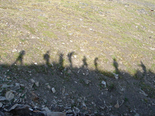
Sunday, July 12, 2009
Zoopies!
Sadly, over the past couple days, more and more of my little zoopies ended up on the bottom of the Erlenmeyer, so I decided to set them free and I returned them to the lake this afternoon ...
Midnight Ride
The rain finally broke last night after two steady days of showers. Everybody was going a bit stir crazy by the end of the week, so Jeremy, Andreas and I went for a bike ride up the Haul Road at about midnight. There are "camp bikes" that are all over camp, which anyone can use. So, we grabbed a few bikes and headed out! It was a great ride! The one factor we hadn't quite accounted for is the muddiness of the dirt roads. By the end of t
he ride, we were all covered in mud splatters from head to toe. My last pair of semi-clean pants are now completely covered in mud... but it was completely worth it. We rode out to the access road of the pipeline and then up to the pipeline itself. It was a tough ride out since it is nearly all up hill heading away from Toolik. The last hill up to the pipeline is super steep and (I hate to admit it) but I ended up walking up part of the hill, which was just as fast as dragging the heavy mountain bike up! Once we got to the top, the fog was rolling back in and the rain was threatening to return, so we turned home.... down, down, down.
When we made it back to the pad, we decided that we needed to document the midnight bike ride since we were all so muddy. These photos don't do justice to the extent of the mud! We all also had racer stripes of mud running up our backs from the back wheels kicking up mud.
Friday, July 10, 2009
The Storm
I woke this morning at 4 AM to the sound of rain pounding down on my tent. Initially I thought I was imagining it, but I quickly realized I wasn't. Pretty soon the storm advanced from rain to howling winds. I have had some difficulty with my tent recently, since the end broke off of one of the poles. After I repaired it, it was almost like new, but the storm definitely put it to the test. The winds were so strong; by 6 AM, the darkening tarp I have secured over my tent with heavy rocks was whipped off. I didn't want to spend the time out in the rain to re-position the tarp on top of my tent, but ventured out to pile extra rocks on top of the tarp--now lying on the ground--so it wouldn't completely fly away. I returned to my tent for another couple hours to ensure that it weathered the storm. Without the extra support of the tarp, the rain fly could only do so much and wind whipped rain up and under the edges of the fly, misting everything inside. Although the tent bucked wildly in the wind for the rest of the morning (and I am a bit worse for the ware) the tent is still standing ...
Wednesday, July 8, 2009
Hike up Falcon Ridge
I escaped the lab this past Sunday to go for a hike up Falcon Ridge, so named
after a supposedly falcon-like rock on the top of the ridge. It was a beautiful day, without a cloud in the sky. However, the wind was not with us one bit throughout the day, and we spent some time fighting off the bugs. We started the hike following the rive up-valley to a saddle in the ridge, where we climbed up steep slopes of skree. It was a bit treacherous going, since many of the rocks were unstable and I was scared that I would step on something really loose and end up careening down to the bottom of the mountain. However, with only minor stumbles and falls we made it up to the ridge and
began our ascent up towards the peak. Although slightly more stable than our climb up, the hike along the ridge seemed rather precarious, bordered one one side by almost a cliff and to the other an increasingly steep slope. As always, though, the view from the top was amazing and well worth the struggle (and the mosquitoes) to get to the top. There was some debate about what rocks the ridge was named after... to the right is two of 3 or 4 candidates as the falcon of falcon ridge. I think that the one on the top looks more like a penguin than a falcon if you ask me!
Acouple of views from the top:


To our dismay, the wind was absent even from the peak, so we had a short lunch and trudged on, following the ridge a ways. Eventually we made it to what Cody coined, the "champaign of shales." There were these amazing slopes covered in a shaley rocks that we "skiied" down. It was really fun sliding down the shales -- and so much faster than hiking down. I decided I liked the term "champaign shales" because as you slide down, the shale makes a tinkling noise like the bubbles of champaign! Along the way we hit a several sections of snow. The rain jackets came out and made instant sleds that brought us down to the foot of the mountain. I think out of everything the snow and the campaign shales were my favorite parts of the day!
Acouple of views from the top:
To our dismay, the wind was absent even from the peak, so we had a short lunch and trudged on, following the ridge a ways. Eventually we made it to what Cody coined, the "champaign of shales." There were these amazing slopes covered in a shaley rocks that we "skiied" down. It was really fun sliding down the shales -- and so much faster than hiking down. I decided I liked the term "champaign shales" because as you slide down, the shale makes a tinkling noise like the bubbles of champaign! Along the way we hit a several sections of snow. The rain jackets came out and made instant sleds that brought us down to the foot of the mountain. I think out of everything the snow and the campaign shales were my favorite parts of the day!
Friday, July 3, 2009
Green Cabin Lake
Sunday I went with the group hiking up to Green Cabin Lake. We originally wanted to just hike up to the lake along a ridge to the south of the lake and then head back. However, we had trouble finding the turn-off and ended up slogging through the tundra for a good while in order to get to the lake. Elissa was supposed to meet several of her PI's (who were choppered in) to stay overnight at th
e lake to fish for a research project about greylings. It took us about 4 or 5 hours to hike up to the lake and once there, we decided that we really didn't want to return the same way. Following a suggestion from one of the PI's we decided to follow the sharp ridge that rises above Atigun Gorage. We continued past Green Cabin Lake and up the ridge, which curves around behind Green Cabin Lake and (eventually) leads back in the direction we hiked from. Despite the low cloud coverage and the steep trip up the ridge, we had beautiful views of the valley. It was awesome. However, 3 hours of hiking up and down and up and down along the ridge, we realized that we were finally about as far from the road as we were when we were at Green Cabin Lake... It was about 6 pm at that point, and we were all starting to tire out. The ridge hiking was pretty rough. There were rapid changes in elevation and we were constantly on skree (loose
rock material). We eventually decided not to continue to hike up and down, but instead side hill across the rest of the ridge. Although it limited our elevation changes, sidehilling across shaley rocks was not the easiest task! at around 8:30 we finally spotted the road off in the distance and realized that if we continued to follow the ridge, we would end up about 2 miles south of where we parked the trucks. However, changing our direction meant that much more time below on the tundra. We decided to B-line for the road and then walk up the road, which is a lot easier than tundra slogging! We finally made it to the road at around 9pm. We were all happy to be down off the mountain, but discouraged about our distance to the cars. One of the guys, Nick, said that he'd be willing to try to hitch hike his way up to the cars (if anyone passes by) and drive back to pick us up. We all started walking up the road (since there was no guarentee that anyone would pass us). Amazingly, after a short while of walking one of the Toolik vans came driving up the road! One of the other sunday hiking groups were luckily on their way back home. Nick and Jason both caught a ride to our trucks and came back to save the rest of us. It was quite an adventure!
Aufeis!
Last Saturday we took a trip out to the aufeis after dinner. Aufeis is basically layered ice that forms due to the freezing of water when the river overflows. These icings form massive layered ice sheets that alternate between blue and white coloring. As the Aufeis melts out, it forms these awesome caves. By the time I got out to see it, most of the cave had colapsed, but apparently it was 30-40 ft long earlier this season!
The aufeis cave from afar...
A close up of the cave showing the different colors of ice
Me modeling my bug shirt next to the ice cave
On the way back home we stopped by the road to look at the muskox who apparently hasn't moved for several weeks. If they have to, the muskox can charge really fast, but they tend to just stay in the same place to graze if un-threatened. We were rather far away, making pictures difficult. From where we were, it just looked like a giant hairy rock with horns.
Subscribe to:
Posts (Atom)